Модуль управления дорогами
Модуль управления дорогами включает пункт бокового меню Отслеживание объектов и раздел Управление дорогами.
Отслеживание объектов
Данный функционал находится в разработке
Раздел бокового меню, предназначенный для выбора детектора, которым будет осуществляться отслеживание местоположения объектов и получение параметров объектов в режиме, приближенном к реальному времени.
Раздел управление дорогами
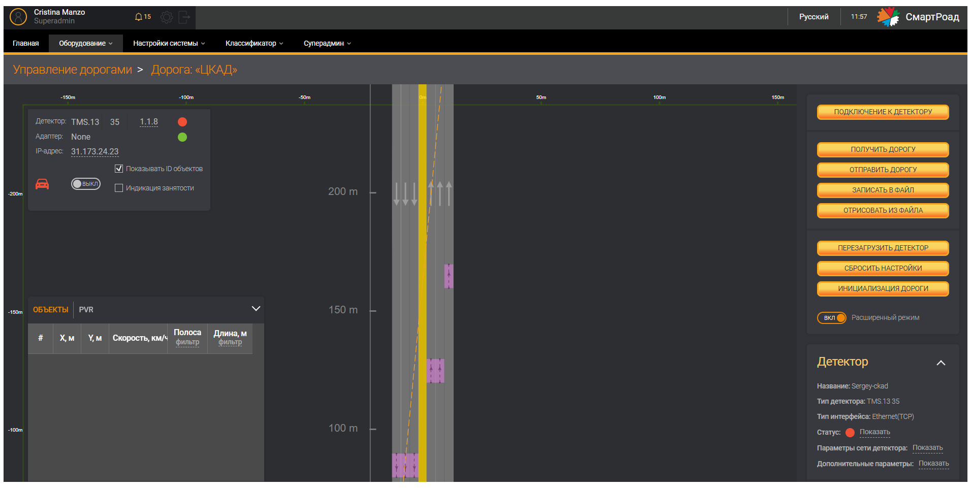
Раздел Управление дорогами включает в себя дополнительный функционал настройки дороги и оборудования, что позволяет настраивать параметры детектора, полосы движения, зоны детектирования, триггеры детектора, с использованием графического интерфейса.
Все настройки детектора могут быть записаны в память выбранного детектора и прочитаны из неё для перенастройки. Настройка данного модуля осуществляется на дополнительном ПО AРМ инженера только инженерами Сорб Инжиниринг в соответствии с Руководством по настройке детектора в АРМ инженера.
Для перехода в раздел Управление дорогами необходимо перейти через Параметры дороги на меню Оборудование и нажать на выбранную дорогу.
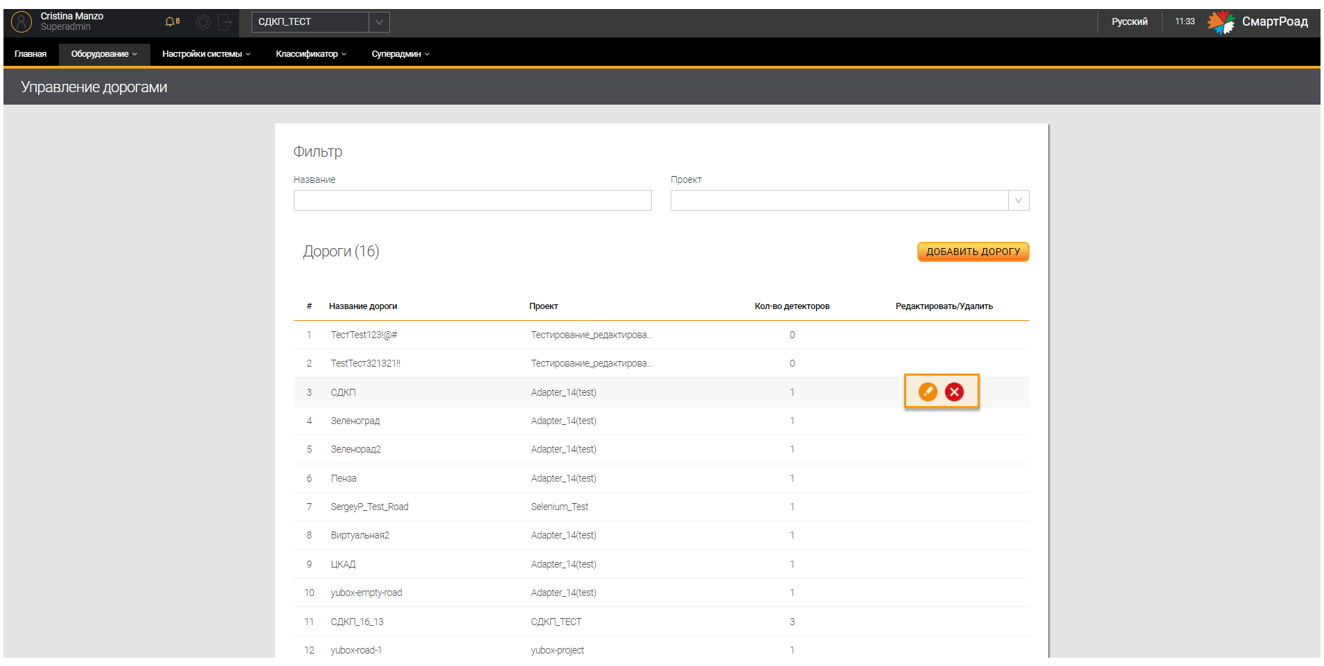
В веб-интерфейсе для пользователей и администратора Системы доступен только просмотр следующего функционала раздела Управление дорогами: Трекирование, Мониторинг данных и Прошивка.
Трекирование
Режим Трекирование позволяет в реальном времени отобразить в графическом редакторе регистрируемые детектором объекты. Данный режим помогает скорректировать настройку полос движения и зон детектирования в соответствии с движением реального транспортного потока.
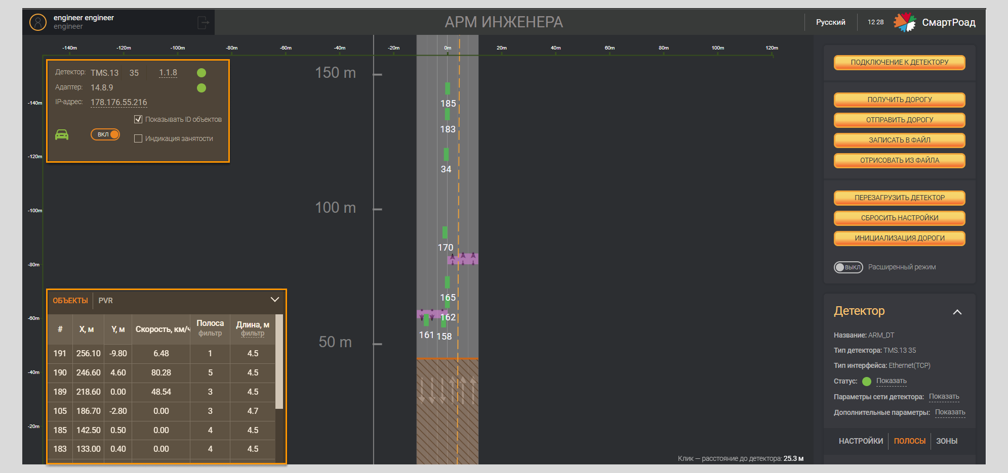
Этот режим можно включить на правой панели
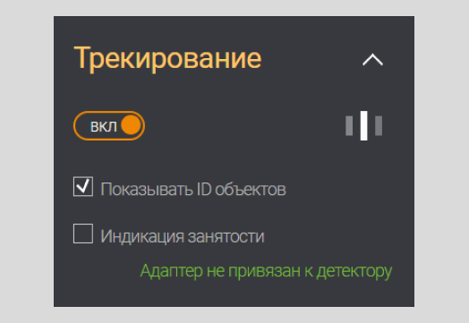
Параметры блока Трекирования
| Параметр | Описание |
|---|---|
| Трекирование | Переключатель режима Трекирования |
| Показатель идентификатора объектов | Чекбокс для включения отображения на экране ID-номеров объектов |
Также можно включить режим трекирования на информационной панели слева нажать переключатель режима Трекирование. В графическом редакторе появятся движущиеся зелёные прямоугольники, обозначающие объекты в зоне детектирования.
Мониторинг данных
Блок мониторинга данных представляет собой таблицу, в которой в реальном времени отображаются данные об объектах, регистрируемых Системой. Данная таблица блока заполнятся данными при включении функции Трекирование. Блок можно раскрыть или свернуть нажав на стрелку. Блок мониторинга данных состоит из двух вкладок Объекты и PVR.
Ниже вы можете ознакомиться с параметрами, доступными на вкладке Объект
| Параметр | Описание |
|---|---|
| # | ID номер присвоенный объекту Системой |
| Х, м | Позиционирование отрисованного объекта на полотне по оси х |
| Y, м | Позиционирование отрисованного объекта на полотне по оси y |
| Скорость, км/ч | Скорость объекта |
| Полоса | Индекс полосы в детекторе |
| Длина,м | Длина объекта |

Вкладка PVR
| Параметр | Описание |
|---|---|
| PVR | Количество данных PVR, собранных детектором |
| Значок обновления | Кнопка сброса всех записанных PVR |
| # | ID номер присвоенный объекту Системой |
| Скорость, км/ч | Скорость объекта |
| Полоса | Индекс полосы в детекторе. |
| Фильтр | Сортировка зарегистрированных объектов по выбранной в фильтре полосе или полосам |
| Зона | Индекс зоны в детекторе |
| Длина | Длина объекта, зарегистрированная Системой |
| Фильтр | Сортировка объектов по длине (от и до). |

В поле От, м можно ввести значение от 0 до 45 м, а в поле До, м от 0 до 45 м.
Прошивка
Вы можете перейти к разделу Прошивка через меню Оборудование и пункт Управление дорогами, нажав на строку в таблице дорог проекта.
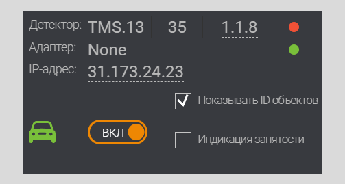
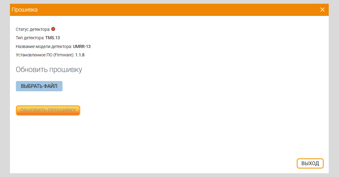
Появится страница управления выбранной дорогой. При клике на подчеркнутый номер перед статусом детектора в таблице, расположенной в верхнем левом углу, появится окно с параметрами прошивки.
Параметры прошивки детектора
| Наименование поля | Описание поля |
|---|---|
| Статус детектора | Отображается статус работы детектора |
| Тип детектора | Отображается серия выбранного для прошивки детектора |
| Название модели детектора | Отображается модель детектора |
| Установленное ПО (Firmware) | Отображается установленная версия ПО |
Описание полей для обновления прошивки
| Наименование поля | Описание поля |
|---|---|
| Выбрать файл | При нажатии на кнопку открывается окно для выбора файла на ПК пользователя. После выбора в поле отображается путь к файлу и название файла: Тип файла: .app |
| Обновить прошивку | При нажатии на кнопку прошивка в детекторе обновляется. |
Поля, значения в которых введены некорректно, будут подсвечены красным цветом. Значения в них необходимо изменить.